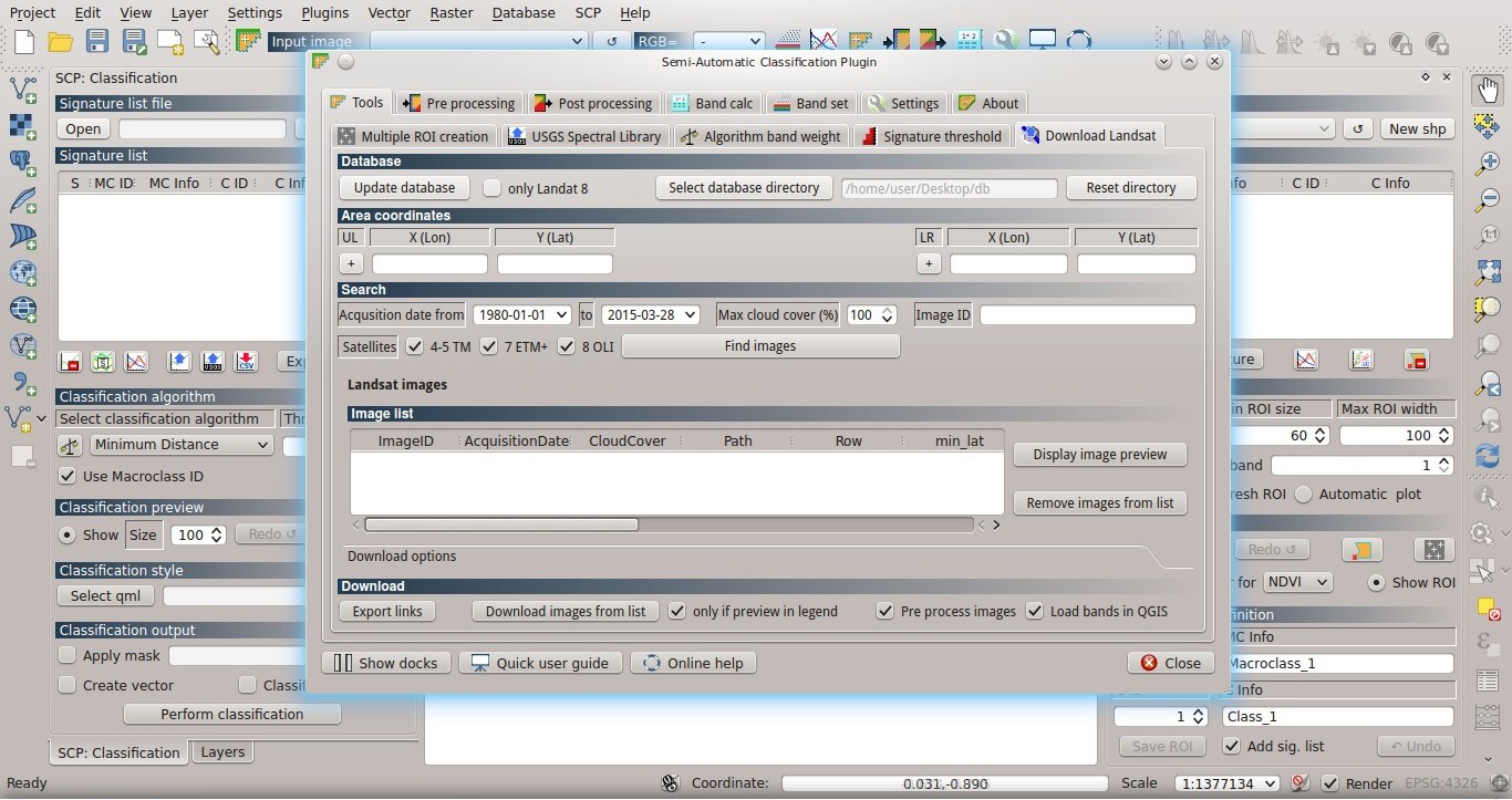
This post is about a major update for the Semi-Automatic Classification Plugin for QGIS, version 4.3.0.
Following the changelog:
-added support for image download of Landsat 4,5, 7 and 8
-improvements to the interface
-improvements to the interface
In version 4.2 of SCP I have added the function to search and download Landsat 8 images from Amazon Web Services.
With this update I have implemented the possibility to search and download the whole Landsat archive using the service from Google Earth Engine. This service allows for the download of a vast Landsat archive of images of the whole world from the 80s to present days.
With this update I have implemented the possibility to search and download the whole Landsat archive using the service from Google Earth Engine. This service allows for the download of a vast Landsat archive of images of the whole world from the 80s to present days.
Please, notice that the service by Google Earth Engine does not allow for the selection of single bands, but the entire dataset is downloaded. Also, some of the images are available only at http://earthexplorer.usgs.gov/ .
In order to search the entire archive, it is required the download of the database (about 500MB). The first time you click the button Find images a window asks for the selection of a directory where the database is stored (in order to prevent deletion when SCP is updated) and the database is downloaded.
The plugin downloads the following files:
http://landsat.usgs.gov/metadata_service/bulk_metadata_files/LANDSAT_8.csv.gz
http://landsat.usgs.gov/metadata_service/bulk_metadata_files/LANDSAT_ETM.csv.gz
http://landsat.usgs.gov/metadata_service/bulk_metadata_files/LANDSAT_8.csv.gz
http://landsat.usgs.gov/metadata_service/bulk_metadata_files/LANDSAT_ETM.csv.gz
In addition, you can choose to download only some satellite databases (the ones checked in Satellites under the tool Search ).
A new option allows for the download of the images in the table Image list which have the preview thereof loaded in QGIS.
For example, you can load several Landsat previews in QGIS, remove from the QGIS legend the ones that are not good because of cloud cover, and download only the images that you see in the QGIS legend.
A new button allows for exporting the download links to a text file, which is useful for downloading images using external programs.
Very soon I am going to publish new tutorials.
Please, remember that a Facebook group and a Google+ Community are available for sharing information and asking for help about the Semi-Automatic Classification Plugin.


